Parleys Creek
Authored by Jess Lofland
The Goshute tribe named Parley’s Canyon, an'ka-so-kuup (meaning “red earth”), after the red-tinted rock lining the canyon walls [01]. Captain Stansbury’s 1852 map indicates the creek was called obit-ko-ke-chee by some indigenous peoples [02]. The canyon was renamed Big Kanyon by colonial settlers. Later, it was renamed after Parley Pratt, who built the “Golden Pass Toll Road” through the canyon. The toll was 50 to 75 cents per wagon, ten cents per pack animal, five cents per head of stock, and a single cent per head of sheep [03].
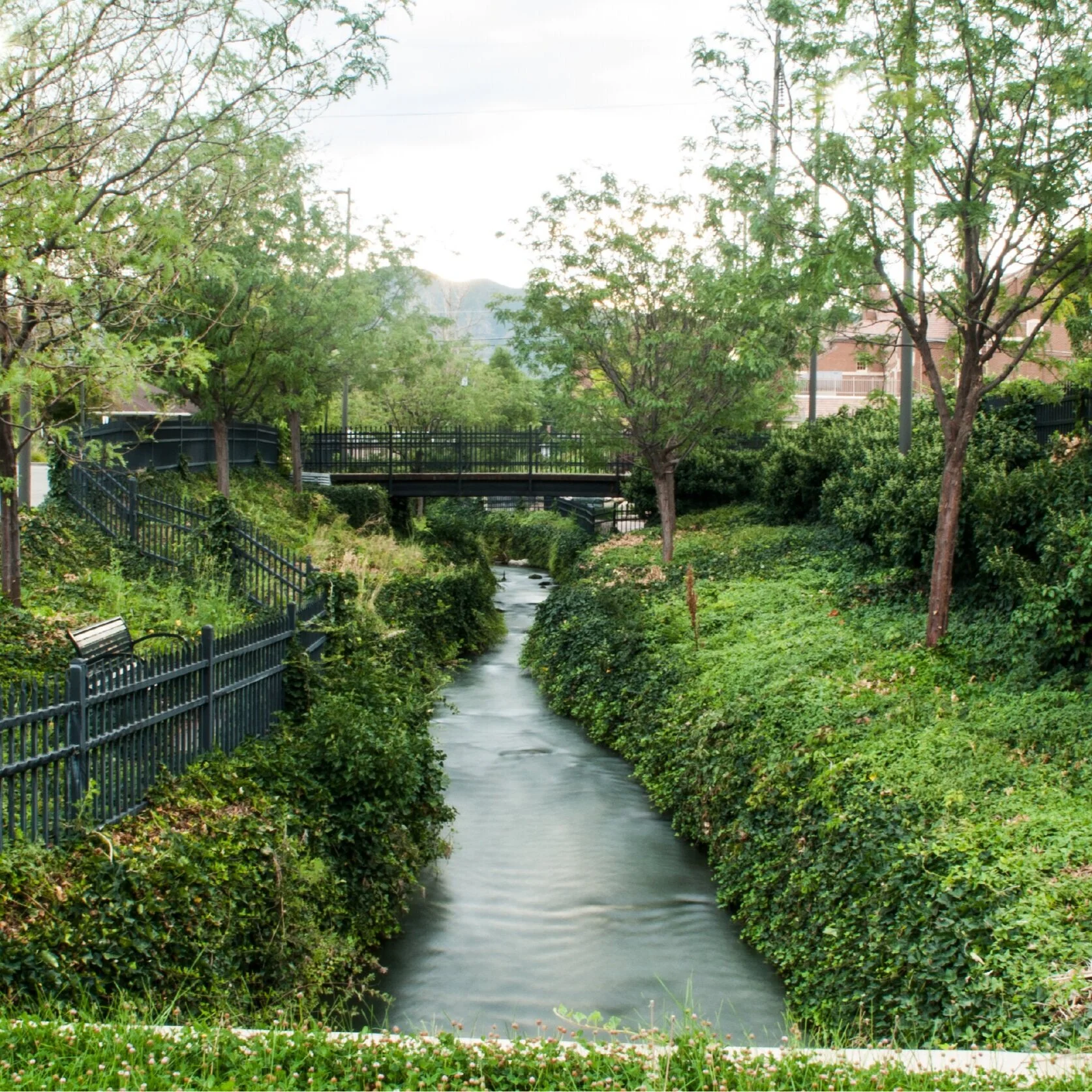
Out of Mountain Dell Reservoir and the water treatment plant, Parleys Creek currently flows underneath Interstate-80 through Parleys Canyon. It was buried in a culvert to make room for the highway. Once it exits the canyon, the creek flows underneath Interstate-215 into Parleys Historic Nature Park. Summertime daredevils often dam the creek before the culvert and “shoot the tube” on the rush of water when the dam is removed.
Downstream, the creek flows through Hidden Hollow, a natural oasis within the bustle of Sugar House. In 1990, Hawthorn Elementary students cleaned up the site and built support to protect the creek, after learning it was slated to become a parking lot for a new shopping mall. A conservation easement was purchase, in 2000, to permanently protect the natural space [04].
Facts
Native Name: Obit-ko-ke-chee or an'ka-so-kuup [Parleys Canyon] (Goshute)
Watershed Size: 58.4 square miles
Total Stream Length: 19.2 miles
Buried: 8.8 miles
Impaired: 9.6 miles
Water Quality Impairments: Cadmium, E. coli, and degraded aquatic habitat condition (observed-to-expected bioassessments)
Average Peak Flow: 35 cubic feet per second
Average Low Flow: 1.5 cubic feet per second
Cities: Salt Lake City
Population Count (2020): 89,606
Median Age (2020): 35
Diversity Index* (2020): 60
Housing Units (2020): 38,002
Owner-Occupied: 50%
Renter-Occupied: 45%
Median Household Income (2020): $67,097
Median Home Value (2020): $355,023
Housing Affordability Index** (2020): 109
My Parleys Creek
An interactive website to immerse yourself in the Parleys Creek watershed, and encourage exploration by reporting issues and publishing stories.
Sources
Chamberlin, Place and Personal Names of the Gosiute Indians of Utah (1913).
Stansbury, Map of the Great Salt Lake and Adjacent Country in the Territory of Utah (1852).
Strack, The Golden Pass: A History of Transportation in Parleys Canyon, Utah (2019).
Olson, Then and Now: Kids Organized to Protect the Environment (2018).
Salt Lake County, Stream Care Guide (2014).
Seven Canyons Trust, Creek Channel Alignment Data (2018).
Seven Canyons Trust, 100 Years of Daylighting (2014).
Utah Division of Water Quality, Beneficial Uses and Water Quality Assessment Map (2016).
Esri, Forecasts for 2020 and 2025 with converted Census 2000 data into 2010 geography using one-mile buffer to creek (2021).
*Likelihood two persons chosen at random belong to different race or ethnic groups, ranging from 0 (no diversity) to 100 (complete diversity).
**Ratio of median household income to median home value. A value of 100 means a typical family has exactly enough income to quality for a mortgage on a typical home. Above 100, the typical family earns more than enough and, below 100, they do not earn enough.


