City Creek
Authored by Jess Lofland
City Creek historically had two arms. The main fork traveled west from the mouth of the canyon, closely paralleling North Temple. The south fork went south towards the City & County Building and met Red Butte, Emigration, and Parleys creeks at about 900 South and West Temple [01].
According to Captain Stansbury’s 1849-50 survey, it was named nah-po-pah by some indigenous peoples [02]. To the Goshute, it was so'ho-gwa [03]. The creek was renamed by colonial settlers due to its proximity to the center of Salt Lake City. The creek was frequented by nomadic indigenous tribes and became the first water source for settlers. It remains a water source for Salt Lake City residents.
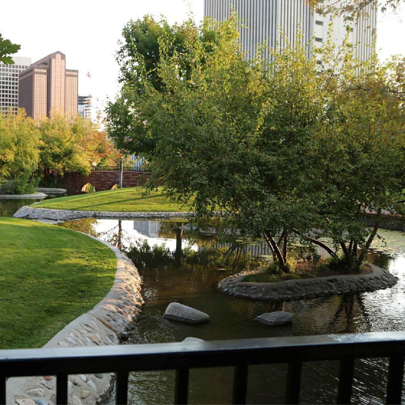
In the 1950s, City Creek Canyon was closed to recreation for over a decade because of its overuse [04]. Today, most of the creek is hidden underneath North Temple as it flows through downtown Salt Lake City. In 1983, the creek famously overtopped its banks and flooded State Street. Kayakers were photographed floating down the thoroughfare, and it was rumored a cutthroat trout was caught in the sandbagged “State Street River.” In 1995, the creek was uncovered in a former surface parking lot at City Creek Park.
Facts
Native Name: Nah-po-pah or so'ho-gwa [Goshute]
Watershed Size: 24.7 square miles
Total Stream Length: 14.6 miles
Buried: 2.0 miles
Impaired: 0.0 miles
Water Quality Impairments: Insufficient data
Average Peak Flow: 45 cubic feet per second
Average Low Flow: 3 cubic feet per second
Cities: Salt Lake City
Population Count (2020): 53,987
Median Age (2020): 34
Diversity Index* (2020): 72
Housing Units (2020): 26,492
Owner-Occupied: 30%
Renter-Occupied: 60%
Median Household Income (2020): $53,587
Median Home Value (2020): $318,223
Housing Affordability Index** (2020): 96
My City Creek
An interactive website to immerse yourself in the City Creek watershed, and encourage exploration by reporting issues and publishing stories.
Sources
Hooton, City Creek: Salt Lake City’s First Water Supply (1975).
Stansbury, Map of the Great Salt Lake and Adjacent Country in the Territory of Utah (1852).
Chamberlin, Place and Personal Names of the Gosiute Indians of Utah (1913).
Niermeyer, Legacy of Watershed Protection (2013).
Salt Lake County, Stream Care Guide (2014).
Seven Canyons Trust, Creek Channel Alignment Data (2018).
Seven Canyons Trust, 100 Years of Daylighting (2014).
Utah Division of Water Quality, Beneficial Uses and Water Quality Assessment Map (2016).
Esri, Forecasts for 2020 and 2025 with converted Census 2000 data into 2010 geography using one-mile buffer to creek (2021).
*Likelihood two persons chosen at random belong to different race or ethnic groups, ranging from 0 (no diversity) to 100 (complete diversity).
**Ratio of median household income to median home value. A value of 100 means a typical family has exactly enough income to quality for a mortgage on a typical home. Above 100, the typical family earns more than enough and, below 100, they do not earn enough.


