City Creek played a significant role in Salt Lake City’s history. For many, the 1983 floods was the first introduction modern residents had to the underground creek. When City Creek was buried, it became out of sight out of mind.
Read More
Looking for something specific? Search our stories, resources, plans, and more—here.
City Creek played a significant role in Salt Lake City’s history. For many, the 1983 floods was the first introduction modern residents had to the underground creek. When City Creek was buried, it became out of sight out of mind.
Read MoreIn 1995, City Creek was carved into a former surface parking lot. City Creek Park provides a natural oasis and amenity in the heart of downtown Salt Lake City.
Read MoreIn 1995, Arcadia Creek was uncovered through downtown Kalamazoo, MI, replacing aging and inadequate flood control infrastructure. It spurred major redevelopment in the area, including $200 million in private development, and generates $12 million annually from large regional festivals.
Read MoreBlackberry Creek is among the first stream daylighting projects. It proved efforts could be safe, even in school grounds. It helped a conservation corps become a breeding ground for local talent, and showed pollution issues better addressed in aboveground channels.
Read MoreThe plan for Salt Lake City’s trails, waterways, and parks from 1992. It lays out progressive, ambitious greenway corridors along City, Red Butte, Emigration, and Parleys Creeks.
Read MoreThis article recounts when City Creek flooded in 1983. Dump trucks and pedestrian traffic were halted to accomodate the river flowing down the center of Salt Lake City down State Street.
Read MoreEfforts on San Luis Obispo Creek in San Luis Obispo, CA show us the power of protecting our urban creeks. Residents rallied around the creek, preventing its burial under a parking lot, and restoring its channel as a community amenity.
Read MoreA 1962 plan to guide Salt Lake City’s entry into its second century of existence. It guides growth, transportation, and beautification. This is the first master plan to suggest uncovering City Creek through the downtown core.
Read MoreA map of the Salt Lake City from 1934. It features the topography of the Salt Lake Valley during this time, which can be used to identify locations of the creeks.
Read MoreA 1920s editorial lamenting the future loss of City Creek as it flows through downtown. Instead of burying the creek, the author suggests creating a parkway for recreation and relaxation—an asset any city “would gladly pay a million dollars.”
Read MoreAn article detailing the historic pathway of City Creek through Salt Lake City, UT.
Read MoreA map of Salt Lake County from 1890. It shows the historic locations of the creeks in detail, including many long lost streams, and some of the major geographical features.
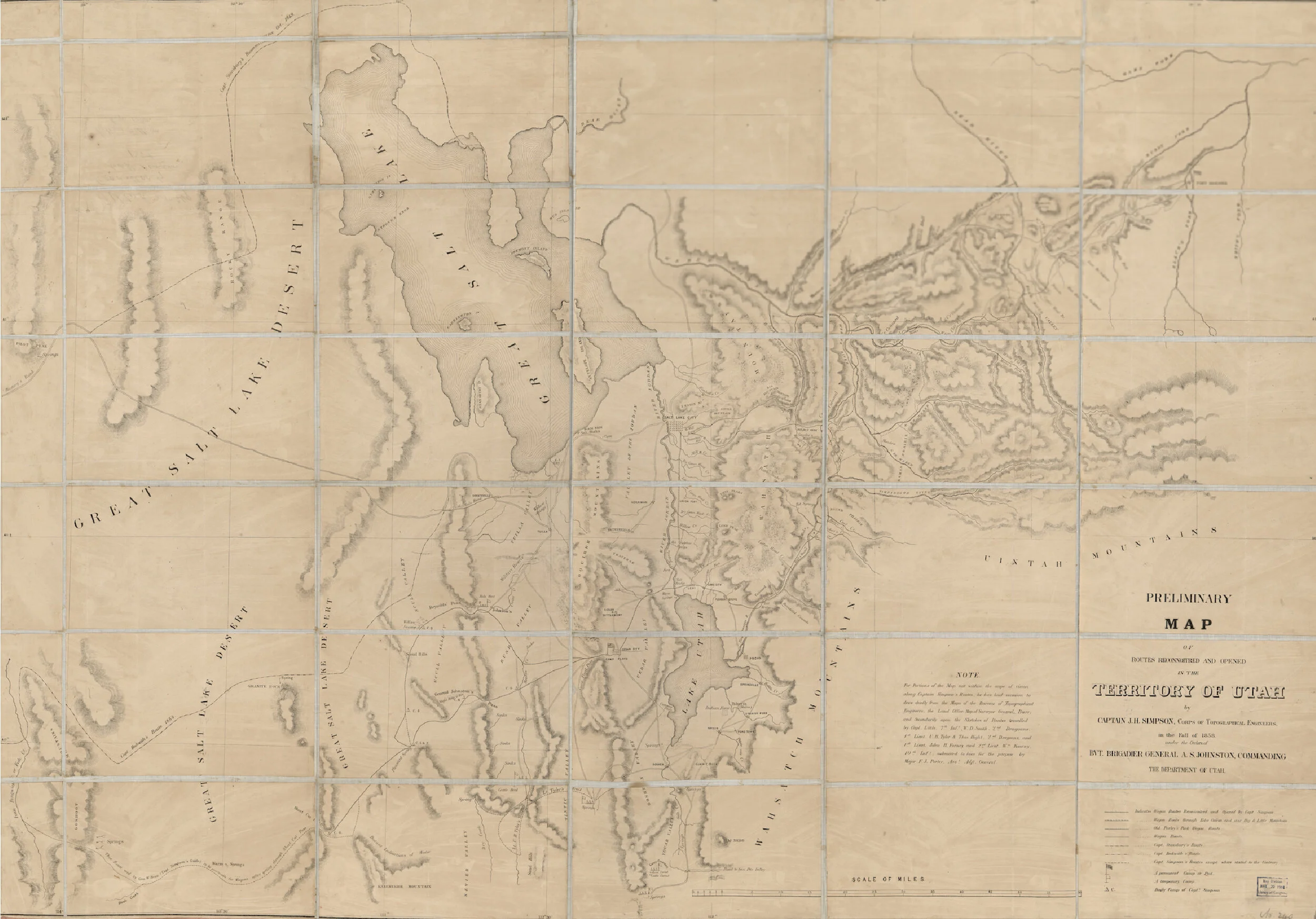
Read MoreA map of the Territory of Utah from 1858. It shows the historic locations of the creeks, and some of the early pioneer camps, trails, and roads.
Read MoreA 1852 map of the Salt Lake Valley and its geological features. It shows where the creeks flowed during pioneer times and showcases the native names of our creeks.
Read MoreA map of the Salt Lake City from 1847. It features the historic locations of the City, Red Butte, Emigration, and Parleys creeks during pioneer settlement of the area.
Read More