A concept plan for the Folsom Trail and daylighting of City Creek in Salt Lake City, UT.
Read MoreA comprehensive assessment for the management of Emigration Creek within Salt Lake City, UT. It includes broad riparian corridor improvements and specific reach-by-reach recommendations.
Read MoreA comprehensive assessment for the management of Red Butte Creek within Salt Lake City, UT. It includes broad riparian corridor improvements and specific reach-by-reach recommendations.
Read MoreAn article exploring early 2000s efforts to uncover City Creek through downtown Salt Lake City, UT. It provides context for modern-day efforts and insights on barriers to daylighting creeks.
Read MoreA study of urban stream daylighting case studies in the United States. It evaluates the success of projects and draws conclusions for the future of this method as a tool for cities to revitalize communities.
Read MoreA 2006 master plan for the Euclid neighborhood of Salt Lake City, UT, defined by North Temple, I-80, I-15, and the Jordan River. It lays out the foundation for the Folsom Trail and daylighting of City Creek, including alignment, design, and surrounding development, amenities, and land-use.
Read MoreA study of stream daylighting and restoration case studies in five medium-sized cities (population 25,000– 80,000) to inform proposed efforts in Caldwell, ID. Efforts addressed deteriorating city centers and downtown areas by addressing flooding concerns, revitalizing local economies, and improving stream-side ecosystems.
Read MoreThis report explores case studies in stream daylighting from across the globe. It describes how daylighting projects are designed, facilitated, and funded, and identifies challenges encountered and lessons learned.
Read MoreThe plan for Salt Lake City’s trails, waterways, and parks from 1992. It lays out progressive, ambitious greenway corridors along City, Red Butte, Emigration, and Parleys Creeks.
Read MoreA 1962 plan to guide Salt Lake City’s entry into its second century of existence. It guides growth, transportation, and beautification. This is the first master plan to suggest uncovering City Creek through the downtown core.
Read MoreA map of the Salt Lake City from 1934. It features the topography of the Salt Lake Valley during this time, which can be used to identify locations of the creeks.
Read MoreA map of Salt Lake County from 1890. It shows the historic locations of the creeks in detail, including many long lost streams, and some of the major geographical features.
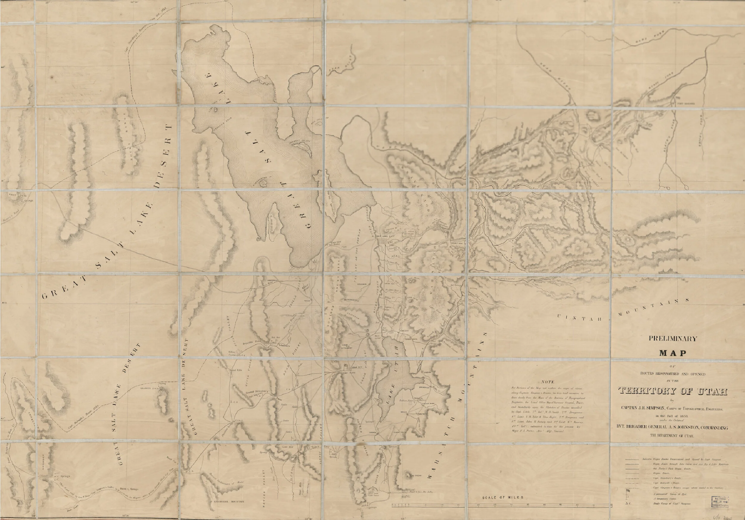
Read MoreA map of the Territory of Utah from 1858. It shows the historic locations of the creeks, and some of the early pioneer camps, trails, and roads.
Read MoreA 1852 map of the Salt Lake Valley and its geological features. It shows where the creeks flowed during pioneer times and showcases the native names of our creeks.
Read MoreA map of the Salt Lake City from 1847. It features the historic locations of the City, Red Butte, Emigration, and Parleys creeks during pioneer settlement of the area.
Read More


